The East Anglian Waterways Association
Promoting access to the navigations of East Anglia for all
| Email EAWA |

The East Anglian Waterways Association Promoting access to the navigations of East Anglia for all |
|
| Home | About Us | Latest News | East Anglian Waterways | The Easterling | Join Us | Directors | NW & Dilham | Work Party | Links | Forum |
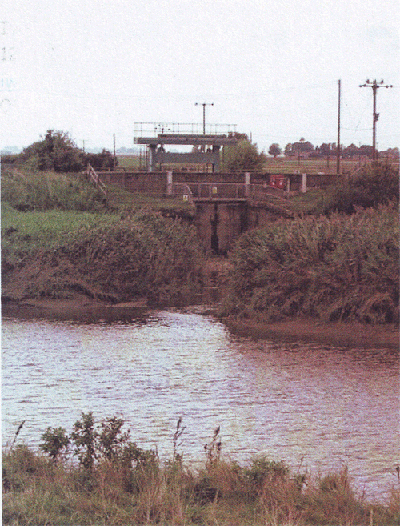
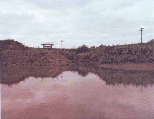
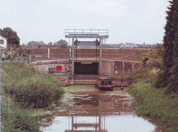
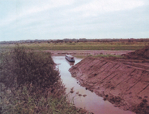
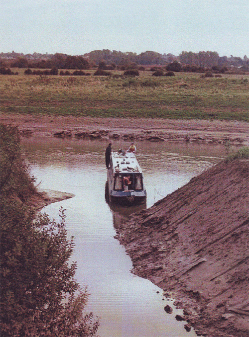
PROJECT HEREWARDBy Alan FaulknerIts objective was to lengthen the locks on the Middle Level Navigations at Ashline (Whittlesey) and Marmont Priory to permit full-length narrow boats to pass through the system without having to navigate out into the tidal waters of The Wash. In part the project was prompted by the lengthening of Stanground Lock at the northern entrance into the system. A downstream extension was constructed to this lock in 1989/1990 with a formal opening ceremony taking place on 9 July 1990. The lock could then pass boats up to 80-feet in length and 11½-feet wide but the draught of boats over 36-feet in length was restricted to 2-feet. Project Hereward's first success came on 21 March 1997 when Marmont Priory was officially re-opened after being lengthened at the downstream end. A formal opening ceremony was performed just over a year later on 12 May 1998. The lock can now pass boats almost up to 90-feet long with a width of 11½ feet. Then at the beginning of November 1998 work started on Ashline Lock with the first boats passing through on 1 April 1999 and a formal opening ceremony being held on 9 September 1999. The lock can now pass boats up to 92-feet in length with a width of 12-feet. Owing to the success of local authority funding applications EAWA only had to make a small contribution to the £56,000 cost of Marmont Priory but at Ashline it provided £8,000 towards the total cost of some £80,000. The remaining lock on the route through to the River Great Ouse is at Salters Lode - this has not been lengthened and can normally pass boats up to 62-feet in length and 12½-feet width. Boats up to 80-feet long however can pass through in the short space of time when high tide in the Great Ouse makes a level.
Alan Faulkner, October 2009 |
| ||||||||||
The Tuesday Night Club on Tour, Tour 2001, part
"1" part
"2" part
"3" in 2, 2 and 3 parts! |
| The Fens Waterways Link includes - Creating a new navigation, using the Old Bedford and New Bedford rivers southwards from Welches Dam to the Great Ouse at Earith, creating a landmark structure at Denver, involving flights of locks and an aqueduct over the New Bedford River, to eliminate the current tidal crossing, and creating a new direct waterway link from Chatteris to Earith. |
| Stanground Sluice | 0.0 | 1 | |
| Whittlesey | 4.0 | 1 | |
| Ashline Lock | 5.0 | 2 | |
| Floods Ferry | 11.0 | 2 | |
| March | 15.0 | 2 | |
| Twenty Foot End | 18.0 | 2 | |
| Junction Pophams Eau | 20.0 | 2 | |
| Marmont Priory Lock | 21.0 | 3 | |
| Upwell | 22.0 | 3 | |
| Outwell | 23.0 | 3 | |
| Mullicourt Aqueduct | 25.0 | 3 | |
| Nordelph | 27.0 | 3 | |
| Salters Lode | 28.0 | 4 |
| The Middle Level Watermen's club is only a few minutes walk from the centre of the town of March. Overnight mooring. Built for the members of the Middle Level Watermen’s Club, we would welcome any Comments, ideas, pictures, and information that can be Shared among the club and visitors! |
| ( ( Harnser
This web site is about Brian and Diana and their Narrowboat “Harnser”. The building of their boat and the journeys they have enjoyed in her - and trip report (coming) in the Middle Level! ) ) |
| The East Anglian Waterways Association is a believer in "Waterways for All" - promoting access to our navigations for the community - whether walkers, nature lovers, anglers, canoeists, boaters or gongoozlers. We work with and support many local societies, trusts and other user bodies in the area - Please visit our LINKS page for more information. |
| ©2013 - East Anglian Waterways Association Limited - Reg. 895405 - Registered Charity No. 251382 |