The East Anglian Waterways Association
Promoting access to the navigations of East Anglia for all
| Email EAWA |

The East Anglian Waterways Association Promoting access to the navigations of East Anglia for all |
|
| Home | About Us | Latest News | East Anglian Waterways | The Easterling | Join Us | Directors | NW & Dilham | Work Party | Links | Forum |
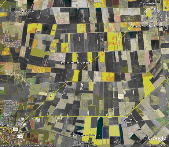
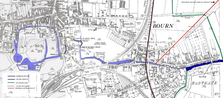
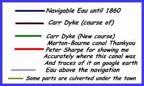
Bourne Eau HistoryThe Eau wasn't Bournes first waterway, the town sits on the Roman Car Dyke. Though some say that the Car Dyke was a drainage ditch and not used for navigation. The Roman Morton-Bourne Canal was maybe the earliest navigation from Bourne to the Sea. The sea in the Middle ages being quite close to Bourne only at the end of Bourne North fen. It was used to carry salt mined at Morton. The course of this canal can be clearly seen on google earth. It ran in a straight line from Near Queens bridge Bourne to a long gone tidal river in Morton fen.
The Eau, a three and a half mile navigation carried goods to the River Glen and on to Fosdyke connected to the sea via the Wash. The Glen also connects to the Welland making a navigable link with Crowland and Stamford. The Eau had two locks, though I can't find any trace of them. Old folk of the
Eastgate area, now long gone, told me that there used to be a lock where the
weir is under Mays bridge.
The first legislation covering the Bourne Eau was an Act of 1781. Trustees were empowered to clean out the navigation and charge tolls. BOURN EAU RIVER. |
The Glen often flooded with water backing up the Eau into
Bourne.
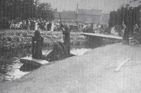
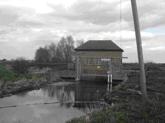
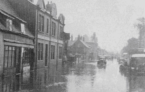 To control the flooding self-acting doors were installed at the Glen/Eau junction. Then in the 1860’s a sluice was installed cutting off the Eau from the Glen and ending any through navigation to and from Bourne. |
Getting around the pump at the Glen junction would also be a major work.
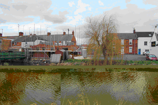 It's very
disappointing to see a house being built on the historic quay. It's very
disappointing to see a house being built on the historic quay.
|
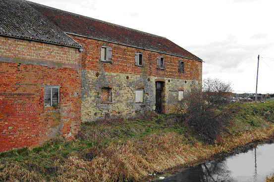
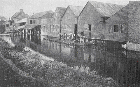
Old riverside buildings just past Mays Bridge.
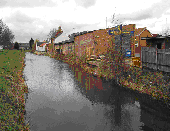
The Eau now has become very weedy and shallow. and is now quite
narrow.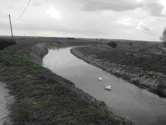 The water level is much higher than the surrounding fields. The small grass banks were often breached in times of flood. |
  | |
 |
Bourne |
| Steve Machin, who wrote this article, would be
pleased to hear from anyone who would like to share information on the Bourne
Eau, Stamford Canal and associated waters. Please email him on |
| The East Anglian Waterways Association is a believer in "Waterways for All" - promoting access to our navigations for the community - whether walkers, nature lovers, anglers, canoeists, boaters or gongoozlers. We work with and support many local societies, trusts and other user bodies in the area - Please visit our LINKS page for more information. |
| ©2013 - East Anglian Waterways Association Limited - Reg. 895405 - Registered Charity No. 251382 |