 |
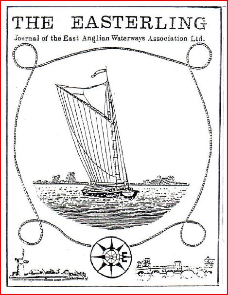
THE EASTERLING
JUNE 2017
Vol. 9, No. 18
The
latest issue of the association's journal has just been published with
news and pictures of our waterways and interesting feature articles.
.......... Read more >>> |
|
 | EAWA NEWS HEADLINES |
|
EA Proposed Sale of Moorings at Ely - Is it lawful?
The Environment Agency, as navigation authority
for the river Great Ouse, has placed on the market three sections of
riverbank at Ely, Cambridgeshire, currently used by businesses
providing vital services to boaters and other recreational users.
EAWA strongly opposes any such sale and believes that given the EA's
statutory obligations under the Anglian Water Authority Act 1977 to
promote recreational use of our waterways it may be unlawful. We
have written to the EA and the Secretary of State for DEFRA expressing
our concerns in detail.
|
ENVIRONMENT AGENCY NAVIGATION CHARGES 2018/19
The
Enviroment Agency has issued a Customer Consultation document on its
proposals to increase boat registration charges for 2018/19. It
sets out the Agency's case, not only for the need to increase revenue
but also controversially to vary the increase across the regions.
An increase of 7.5% is proposed for Anglian Waterways but the Thames
region's increase is 5.7%.
East
Anglian Waterways Association does not accept the EA's case, either for
any increase in charges above the rate of inflation or the rationale
for unfair regional variations.
Read the EA Anglian region consultation paper HERE
and the full EAWA response HERE
In summary, EAWA considers that:
- There is no justification for any increase above CPI.
- Unfair regional variations are completely unacceptable.
- The EA must meet its Statutory obligations in full and can increase revenue by encouraging greater use of our waterways.
- There
is a huge potential in this region to save costs by properly harnessing
the goodwill, expertise and enthusiasm of volunteers as is done so
successfully elsewhere on the national waterways.
August 2017
|
|
Hartford Marina Lodges NOT 'vessels' say High Court Judges
The Environment Agency's appeal to the High
Court against a decision by Peterborough Crown Court to quash
convictions of two owners of static floating lodges for failure to
register their homes as vessels has been dismissed.
The three senior judges were unanimous in their opinion that the homes
were not vessels for the purposes of the EA (Inland Waterways) Order
2010. They rejected most of the arguments advanced by the EA's
Counsel, Mr David Perry QC and found that the lodges were constructed
and used as homes on water and not to "carry" people or things or to be
"propelled or moved" across the water. On a realistic view of the facts
they are not "vessels" for the purposes of the Order.
Read the full 42-page High Court Judgment HERE
15th April 2016
|
|
|
Review of Environment Agency navigations
A statement from EA and CaRT issued 19th February 2016
The Environment Agency (EA) and
Canal & River Trust (the Trust) have established a joint working group to
explore different options for running the 620 miles of EA-managed river
navigations. It still remains the Government’s ambition to transfer the
EA’s responsibility for navigation of the rivers to the Trust, subject to
affordability and approval by the Trust’s Board and the Minister. This
will help realise the benefits of a sustainable navigation and give the public
greater involvement in the running of the waterways.
The working group is at a very
early, information gathering stage, and no decisions have yet been made on the
details of a potential move.
The working group will begin
with an information and data gathering exercise looking at all of the EA’s
navigations, including: the non-tidal River Thames; the River Wye; the upper
Medway; the East Anglian navigations and Rye Harbour.
As the project moves forward the
working group will investigate the various potential options required for such
a complex move and will be seeking to understand your views and aspirations as
well as those of other stakeholders.
The EA, the Trust and Defra are
committed to finding a sustainable future for the EA’s river navigations and to
working with the communities who use them.
|
Project Hereward - Technical Progress and a Funding Boost - READ MORE
|
|
|
Our
Mission
The EAWA believes in
"Waterways for All" - promoting access to our navigations for the
community - whether walkers, nature lovers, anglers, canoeists, boaters
or gongoozlers. We work with and support many local
societies, trusts and other user bodies throughout East Anglia.
We publish a
regular newsletter - 'The Easterling' - bringing
together information on the waterways of our area. Want to
read the latest issue? Just CLICK HERE
EAWA arranges
work-parties for waterway restoration, improvement and maintenance and
offers advice, support and funding to local organisations with similar
aims. |
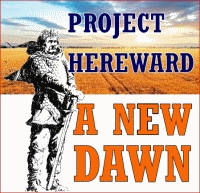 East Anglian Waterways Association and Peterborough IWA
have joined forces in PROJECT HEREWARD to re-open
the Forty Foot between the Middle Level and Great Ouse
system via Horseway and Welches Dam as a
WATERWAY FOR ALL East Anglian Waterways Association and Peterborough IWA
have joined forces in PROJECT HEREWARD to re-open
the Forty Foot between the Middle Level and Great Ouse
system via Horseway and Welches Dam as a
WATERWAY FOR ALL
The Project Hereward team now meets every month to develop the programme of action to meet its aims.
Good News from the Little Ouse
Progress on Thetford Council's exciting new bid to bring boats back into the town centre
Thetford
Town Council has now agreed a sum of £15,000 (max) towards the
feasibility study and also been invited by the neighbouring Breckland
District Council to apply for £20,000 matched grant funding. Breckland
is in turn negotiating with Forest Heath District Council seeking added
support. EAWA welcomes this initiative. Re-opening the Little Ouse navigation will bring economic and other benefits to a wider area of West Norfolk.
Tina
Cunnell, leading the project for Thetford TC, is working on the
Water Space Study and will discuss with the Environment Agency
integration into the wider regional strategy.
Full news of the Town Council's Plans and other background information ... Click here |
|
The
Present
- Supporting the work of the North Walsham and Dilham Canal Trust,
established by the EAWA, to restore the navigation and improve the
waterway for all, in co-operation with the canal owners.
- Working
with partners to support the Fens Waterways Link, a long-term project to join and extend the Lincolnshire and
Cambridgeshire waterways for navigation.
- Working with IWA Peterborough on Project Hereward to re-open the Old Bedford/Forty
Foot southern link of the Middle Level and Great Ouse systems.
- Supporting
the Sleaford Trust, working to reopen the upper part of the navigation
within the town.
- Supporting
the River Gipping Trust in its aim to preserve the historic heritage of
the Stowmarket Navigation.
- Working
closely with the Nene Waterway Task Group and the Great Ouse Boating
Association and campaigning for improved management of these rivers.
- Working
with the Broads Authority and other bodies interested in the Norfolk
Broads.
- Making
our East Anglian Waterways better known by arranging trips or
activities, such as in conjunction with our AGM.
|
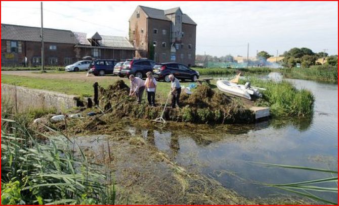 NORTH WALSHAM & DILHAM CANAL NORTH WALSHAM & DILHAM CANAL
Recent work parties organised by the Trust have made great progress in
the section above Ebridge Lock, particularly around Bacton Wood and
Pigneys Wood. Our picture shows the volunteers clearing
weed from the mouth of Ebridge Lock in August 2015. The Trust
always welcomes new volunteers and full details can be found on our WORK PARTY page or on the NW&DC TRUST website or by calling 01603 738648.
Picture: Kevin Thomas / Alan Bertram
|
The River Blyth Navigation - a future restoration project?
This little known Suffolk waterway running
for 10-miles from Halesworth to the sea at Southwold was once an
important navigation. There were originally five locks in total in the 4½ mile
non-tidal stretch from Halesworth down to Blyford.
A
half-mile section in Halesworth, registered as a 'village green' is
being cared for by volunteers. The HALESWORTH NEW REACH TRAIL is
an interesting walk of about a mile following the old navigation
channel from the Town Quay to Halesworth Lock.
|